Background
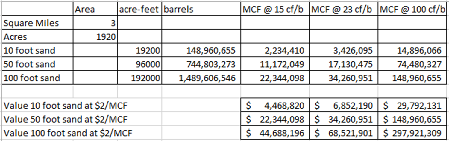
Based on work with lightning volumes in the Houston Metropolitan Area there appears to be significant shallow hydrocarbon accumulations. This Lead identifies and defines the most concentrated portions of one of these accumulations as being about 3 square miles in size. If the sands are 10 feet thick and there are 15 cubic feet of methane per barrel of water, this accumulation has a value of $4.5 million at $2/MCF (thousand cubic feet of gas). If the sands are 100 feet thick and there are 100 cubic feet of methane per barrel of water, this accumulation has a value of $300 million at $2/MCF. We realize gas prices are lower than when we originally did this work.
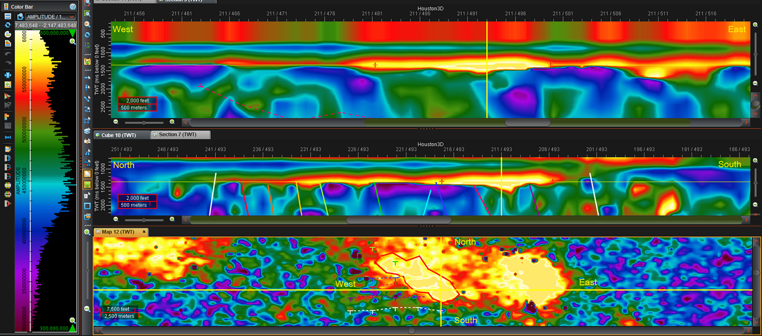
Lightning Cross-Sections:
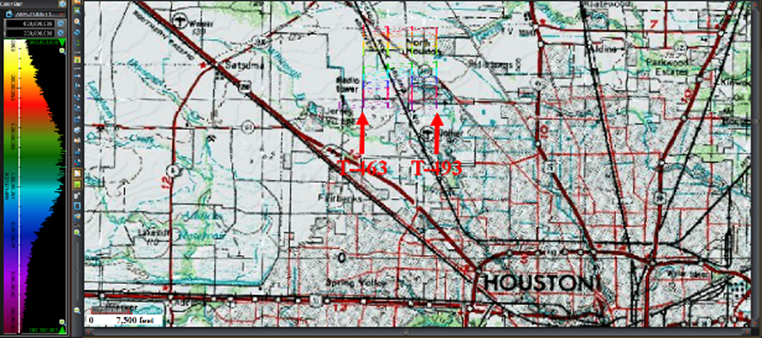
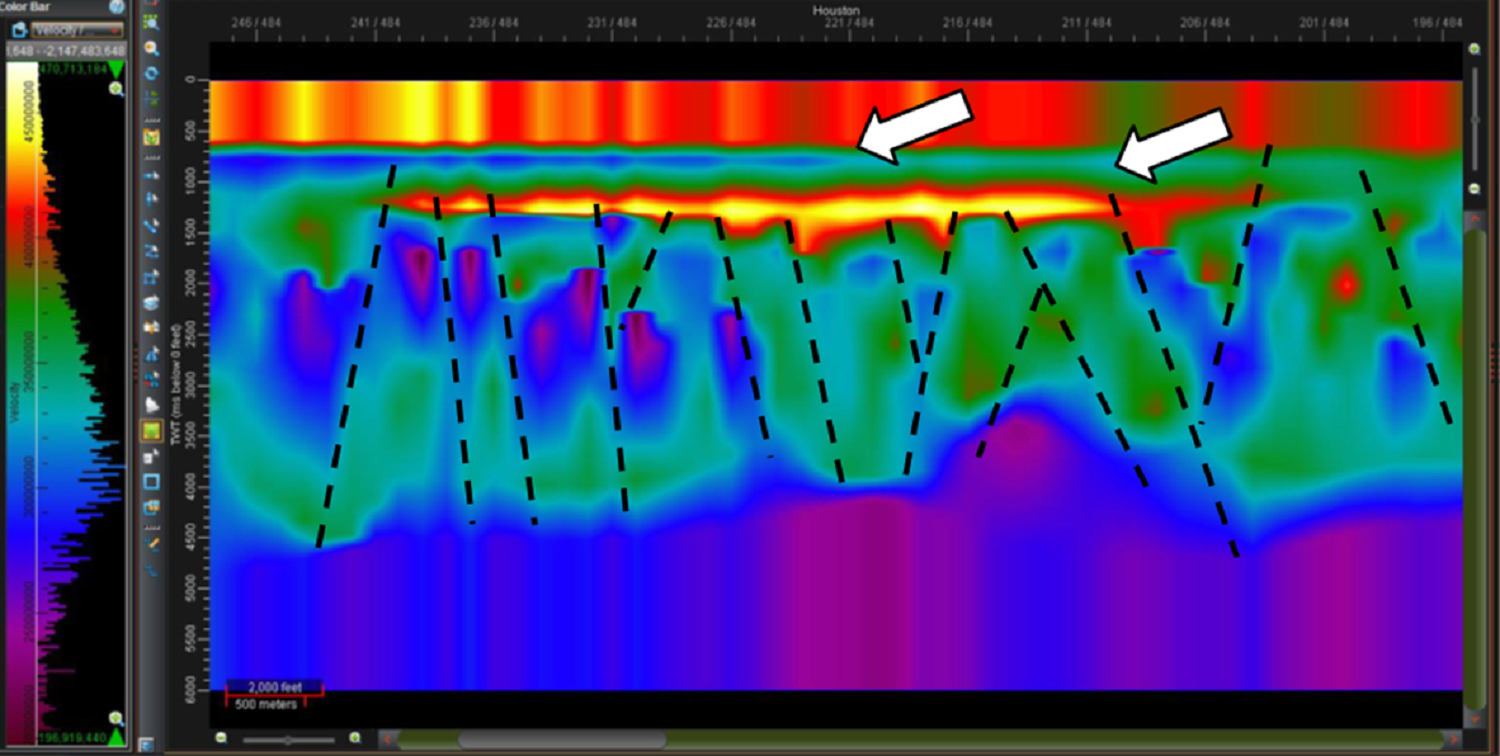
Louie Berent interpreted a lightning derived resistivity section, which Roice Nelson had pulled from the Houston lightning analysis test area and displayed for DML marketing purposes. Images showing this work are below this text.
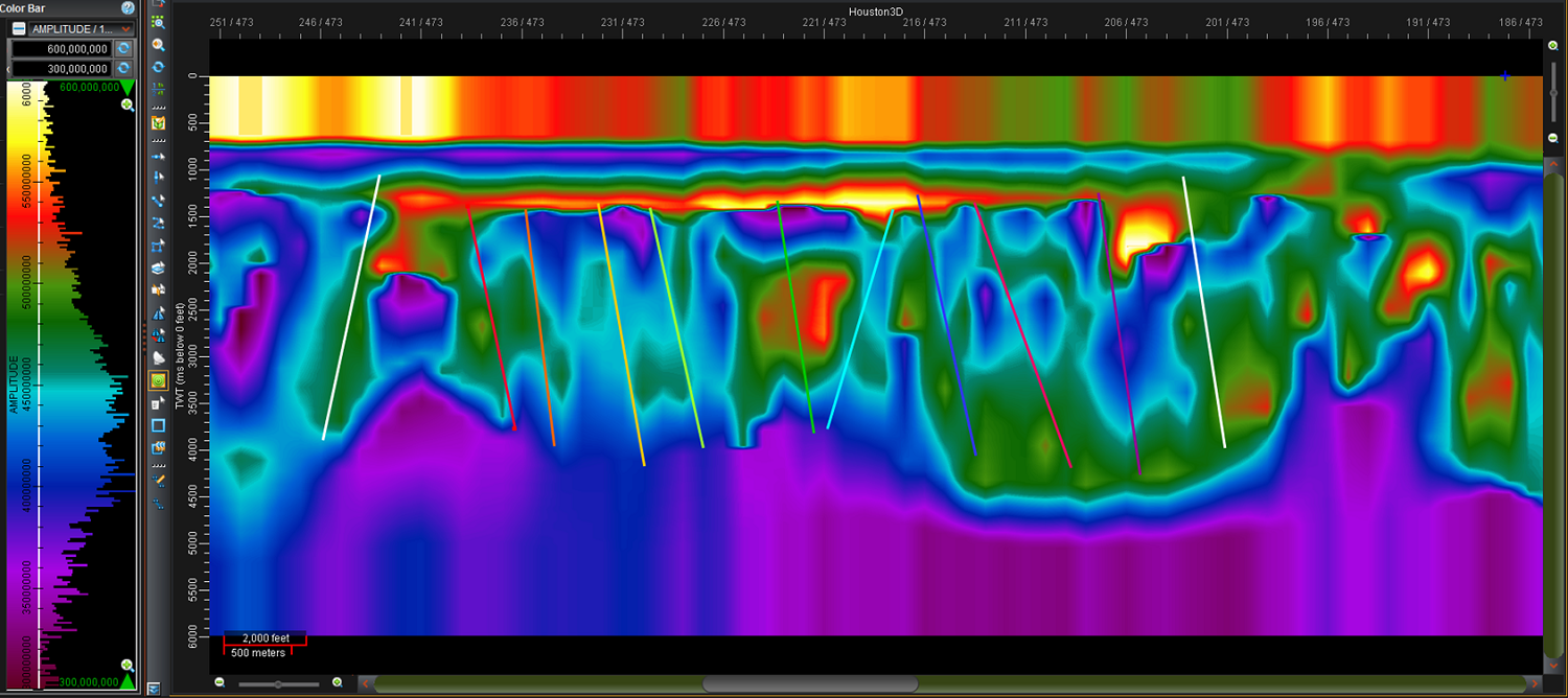
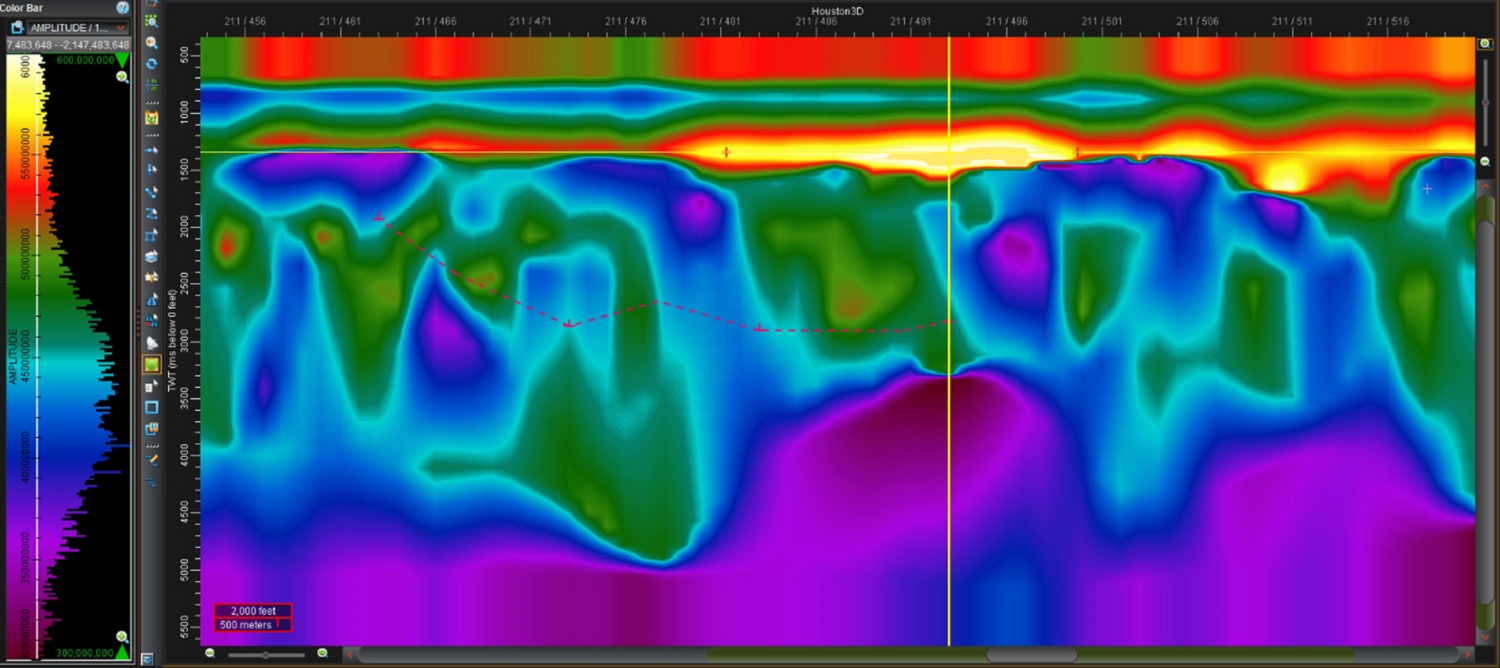
The initial geologic point of interest was the conductive stratigraphic pinchout (blue) just below the no data area on the first cross-section (left arrow above). There was also a lens, which looks like a sand lens, with a high resistivity anomaly (right arrow above). Louie tied surface faults to this same data set about 20 miles to the west of here, which will be the topic of a future White Paper. The faulting pattern underneath the anomaly popped out and he drew in a fault interpretation.
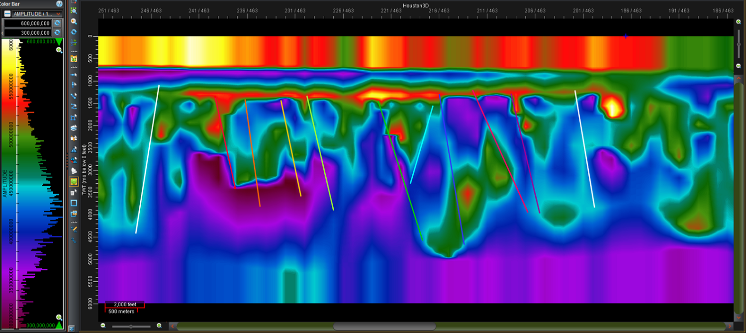
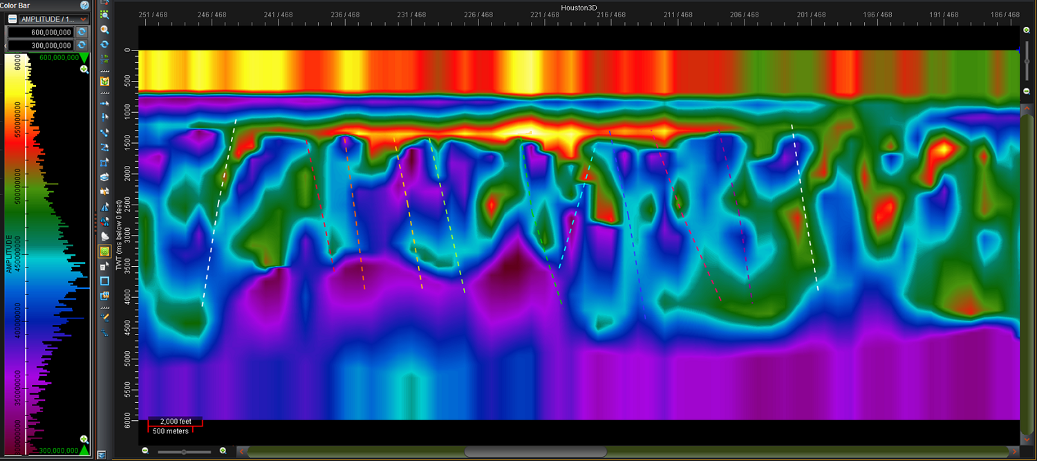
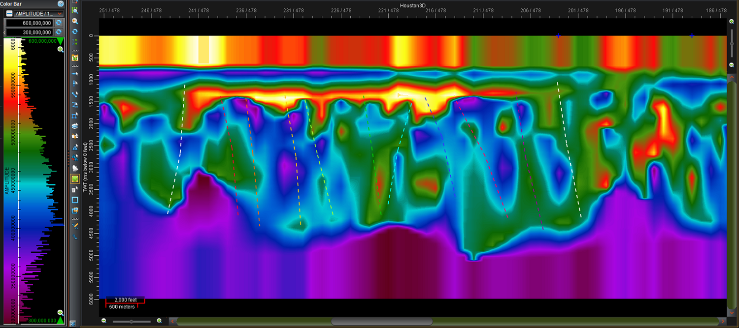
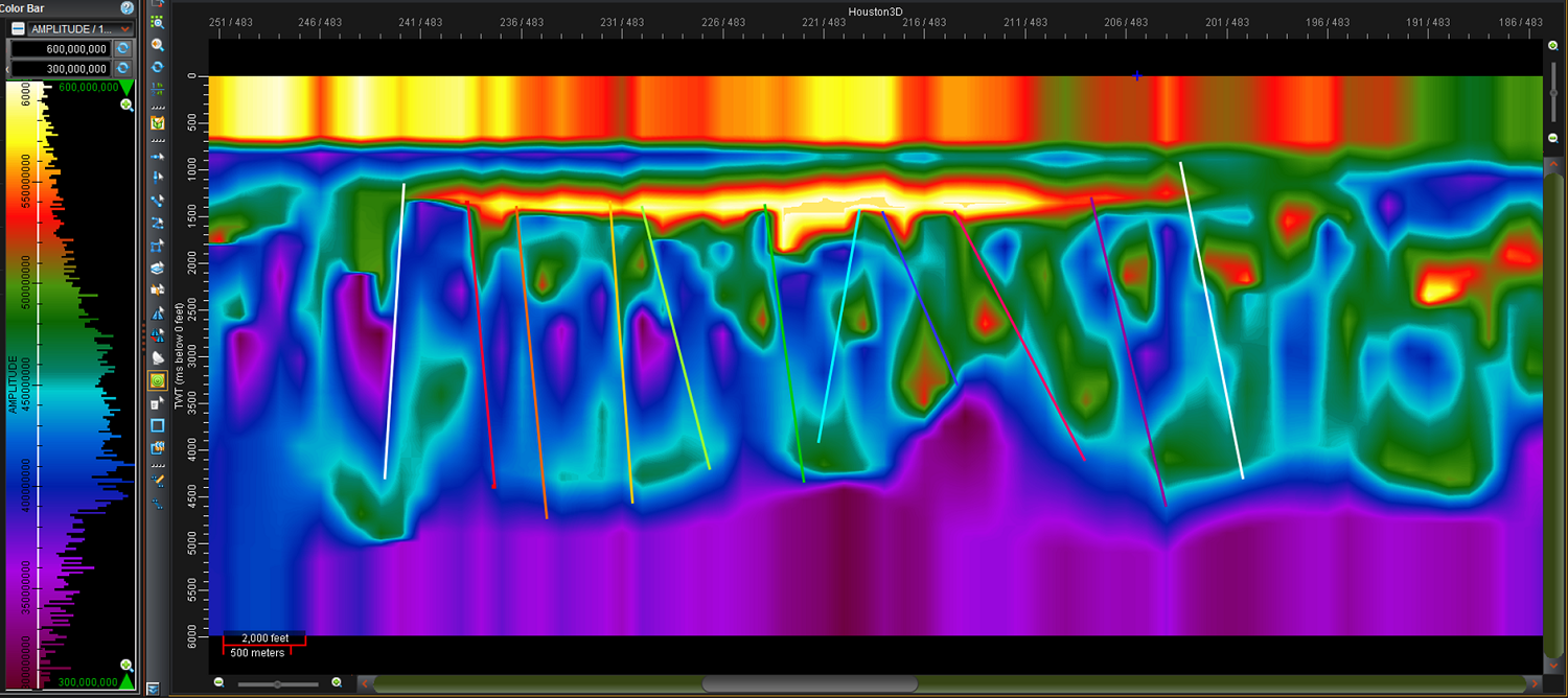
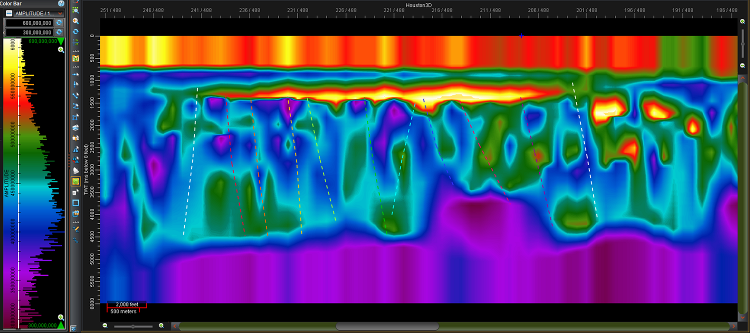
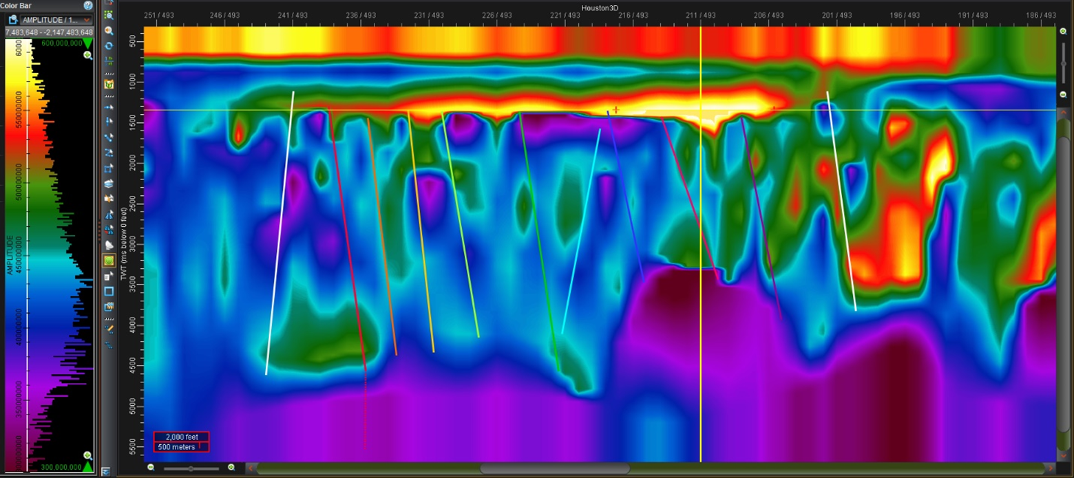
Roice displayed the data and interpreted 10 faults on every 10th cross-line (XL) across the anomaly to see if the obvious geologic nature of the first image carried laterally. Every 5th line from XL-463 to XL-493 from the lightning derived resistivity volumei are shown below. Note the interpretation was every 10th line and faults are interpolated as dashed faults on the cross-lines in between the cross-lines used to pick faults on.
Obviously, there is good continuity between these sections. The geology on each of the sections changes, and so in 3-D the anomaly retains its geologic appearance. So, what would cause high resistivity like this at 1345 milliseconds? At 6,000 feet per second, 1345 ms is about 4,000 feet deep. Our first thought was natural gas accumulations. However, fresh water is also highly resistive, and fresh water makes resistivity logs unreadable for the first few thousand feet in this part of the world. On the other hand, fresh water does not typically pinch out with the lens appearance seen on this display. So, a conservative interpretation is that this is a gas charged aquifer.
Gary Farnsworth Player has introduced us to the ubiquitous nature of gas bed methane. It makes perfect sense in this part of the Gulf Coast to have shallow aquifers which have higher concentrations of gas at certain locations. DML has talked about the potential of lightning analysis, and specifically resistivity volumes to be a valuable tool to identify exploration sweetspots. If this is a prospective gas bed methane accumulation, it could have tremendous value to the city of Houston, who could build a gas power plant and create a renewable energy source for the city. This also appears a good place to prove Gary’s concept.
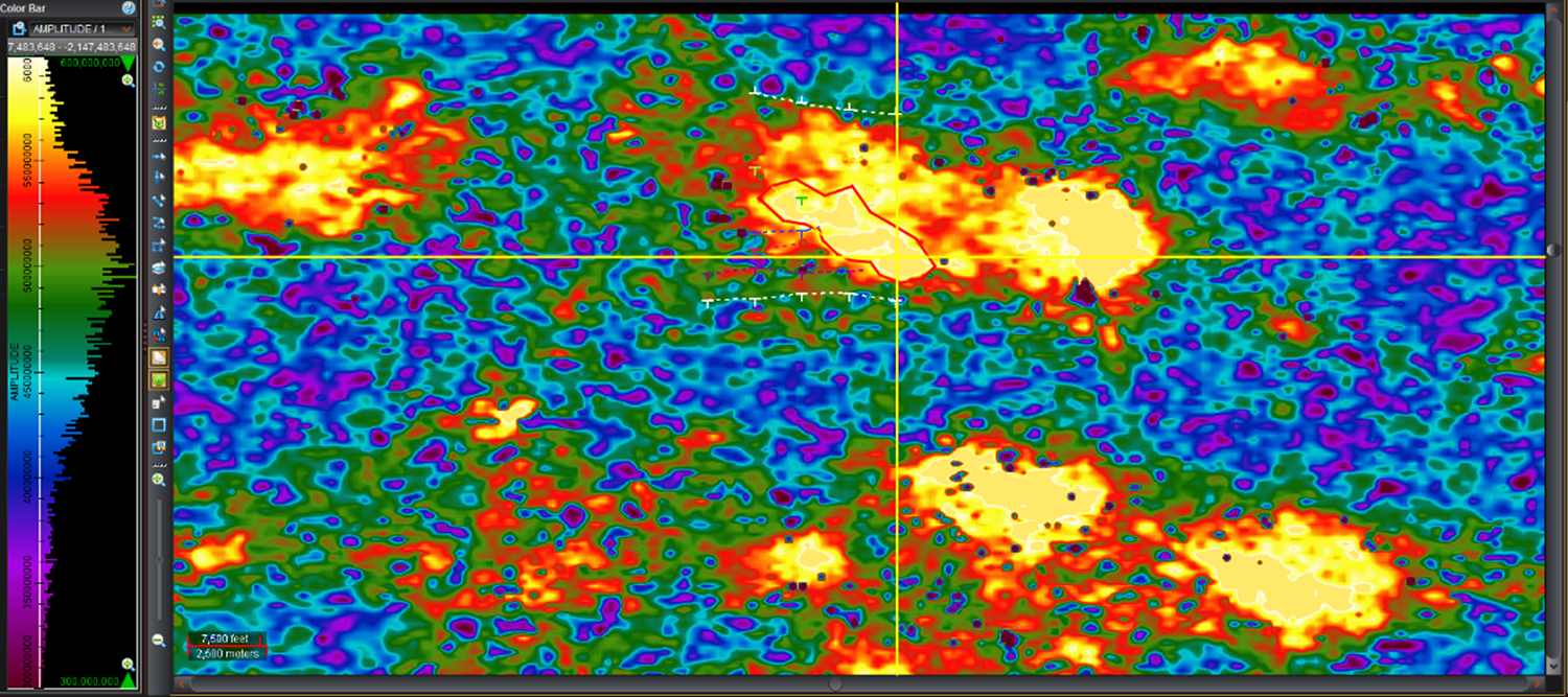
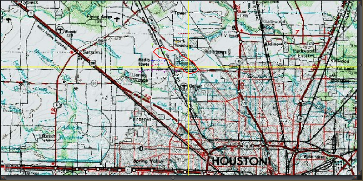
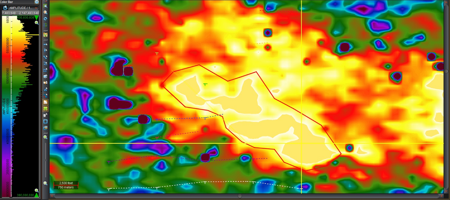
To further evaluate this the following screen captures of In-Line (west to east), Cross-Line (north to south), Time-Slice, and maps across the anomaly were collected and the highest concentration outlined.
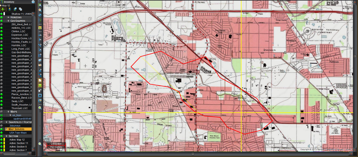
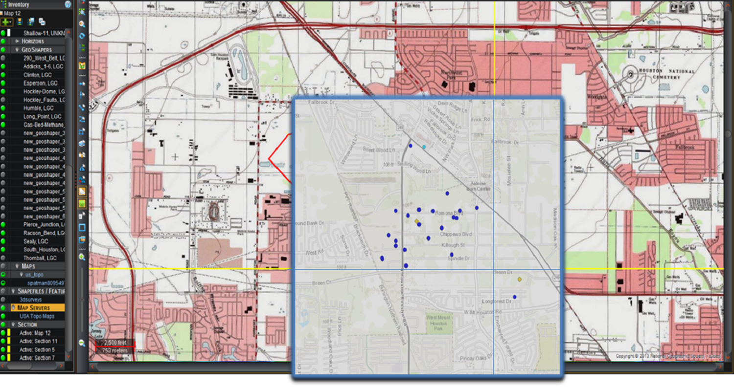
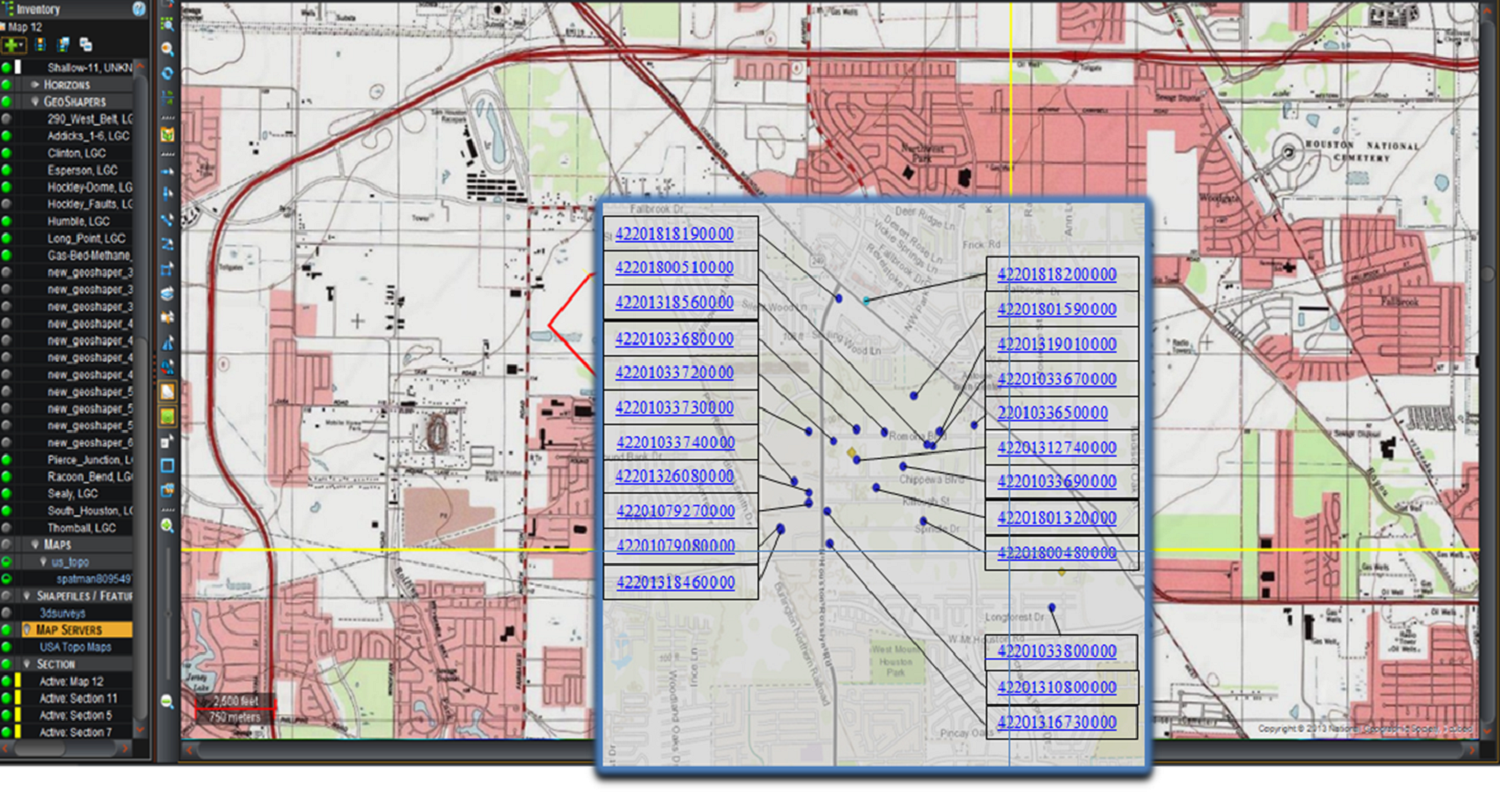
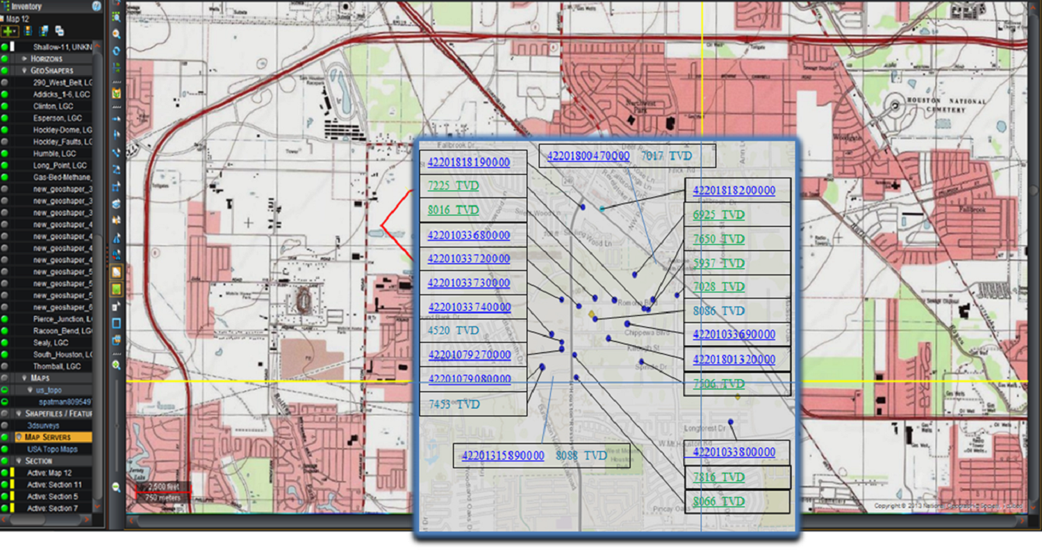
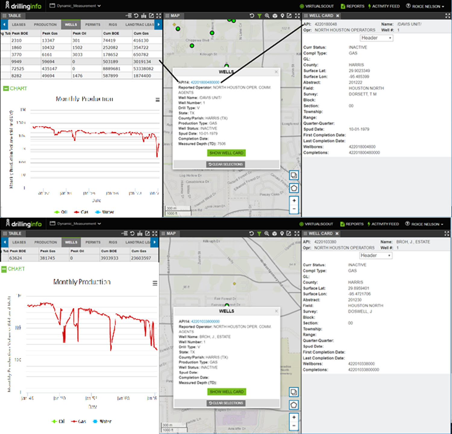
Later we obtained access to Drilling Info databases through Tom Sherman, who has since died of heart problems. Maps below show the wells in this database drilled into the anomaly (note the blue line intersection shows where the lightning data proposes drilling the well).
The lightning derived location is a little north of halfway between wells 42201800480000 and 42201033800000. The production information for 42201800480000 from Drilling Info is here (spudded 1979).
In research with The Global Basin Research Network, which Roice helped form, we proved Eugene Island 330 had a historical hydrocarbon refilling event. We think this is more common than is understood in the Gulf Coast, and so it is our assumption the high resistivity anomaly is a result of a natural gas replenishing event, which refilled the reservoir Texaco walked away from decades ago.
The other factor is the northwest well produced 503,189 cubic feet of gas from 1961-1972 and the southeast well produced 236,036,597 cubic feet of gas from 1945-1965. It is a reasonable assumption these sands were recharged with gas since 1965-72, and that the lightning data from 1998-2008 is showing anomalies from a recharged gas reservoir.
|